Several of the items in an
Assessor's report contain information that is useful
in finding your home’s history. These include the:
Owner name: The
current owner’s name and address is listed. If
this is your own home, this will confirm that you
have found the correct property record.
Map #: This is the
Township (29S), Section (12W) and Range (8DD) used
to locate the property on a surveyors map. It also
includes the parcel number (6600 0).
Value Area: This is the
value of the property on a six point scale (1 is the
lowest and 6 is the most elaborate). This
information is useful as it gives a rating as to the
condition of the house as it compares to others in
the same general area. The actual real market value
(RVM) as determined by the county assessor is also
listed on the report.
Block and
Lot
numbers: Presently, the Assessor’s records do
not include this information. You will need to visit
the survey office or review the deed for the
property to discover this information.
Situs: The term situs is
Latin meaning “location”. It is the actual
location of the house.
You may go directly to
the Coos
County Assessor's Search to search for your
house. You can also find the assessors maps online
here.
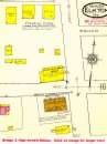
You may also want to see if you
can obtain a copy of the Sanborn
Fire Insurance Company map for your town. For those folks in Coos county,
the Coos County Library now offers these Sanborn maps online and in the
branch libraries using their Proquest subscription service. More information on the Sanborn Insurance Maps can
can be found here as well.